
There are a lot of smartphone GPS-based navigation apps on the market. Through personal use around the globe as well as thorough research and review these are our picks for the best GPS apps. The ubiquitous Google Maps reigns supreme for the best overall GPS app, but it’s not the best for every application. Other apps are better suited for specific travel conditions and needs. Our list is not exhaustive, as there are a plethora of options out there. Our list is a great place to start with proven winners, however.
Best Overall GPS App: Google Maps
The king. You didn’t expect anything else in the top spot, did you? With the massive resources at Google and the bajillions of users, other app developers will be hard-pressed to surpass Google Maps as the best GPS navigation app. And it’s free. Not freemium, no in-app purchases. Just plain free.
Google Maps has all the features, including many that aren’t commonly known. These include; automatic rerouting, traffic information (which Google acquired in 2013), and multiple map styles. Some map style examples are; terrain, satellite, and Google Earth integration.
I live three miles down a dirt road, and at first, Google Maps would send people to the back of my property. But quickly, the error was corrected without any voluntary input from me. The only error in the app that I’ve seen lately in navigation is road closures in remote areas not being listed.
The all-encompassing app also has street level and interior imagery of destinations, and optimization for walking, biking, and public transportation. There is even an Augmented Reality (AR) based navigation, ability to book a cab, or message a restaurant, all through the app. Google maps can toggle tolls off, add multiple stops to the route, and store parking spots.
Location can be shared, and Google Maps can even create a shortlist of restaurants and do a real-time poll to eliminate the group text battles. If you think a feature might be helpful in a navigation app, Google Maps probably already does it.
There is a significant limitation of Google Maps. It works offline, but map storage is limited to 2GB. That is only enough for a 200 by 120-mile area. Sadly that isn’t a large enough detailed map to cover even a one-day road trip for many.
It’s difficult to overthrow the king, however. Google Maps offers the best turn-by-turn directions in the busienss.
Google Maps is available for iOS and Android for free. Try using it with Apple Car Play or Android Auto for a truly enjoyable user experience.
Best for Avoiding Traffic: Waze
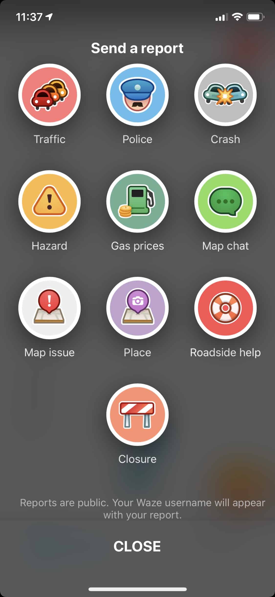
Waze crowdsources data to help you avoid traffic, cops, speed traps, disabled vehicles, and other hazards, crashes, and road closures. You can even find reasonable gas prices with the help of 115 million users.
Austin, TX has horrendous traffic, and Waze has never failed to keep me from the worst of it, routing me through shortcuts that even I didn’t know about after living here for 34 years.
The app’s estimate of arrival has been very accurate for urban destinations. But in more remote rural areas, the accuracy drops, both for navigation directions and estimation of arrival, presumably due to lack of users in the area. For city driving, nothing beats Waze to keep the frustration levels in check. The interface is intuitive and friendly. No need to research how to do anything on Waze.
When planning and getting around traffic is the primary objective, Waze is the best GPS app.
Waze is available for iOS and Android for free.
Best for Off-Line Navigation: Sygic GPS Navigation
Sygic is a Slovak company that boasts 200 million users of its navigation app.
Sygic’s claim to fame is the ability to download visually stunning 3D maps for offline use. These maps are updated regularly, free of charge. Offline navigation can be crucial in remote areas with spotty signal or when traveling abroad to avoid roaming charges.
Aside from navigation, Sygic can find the best parking, fuel prices, and warn you of speed limits and speed cameras. Real-time traffic information, route sharing, and lane choice guidance are also Sygic functions.
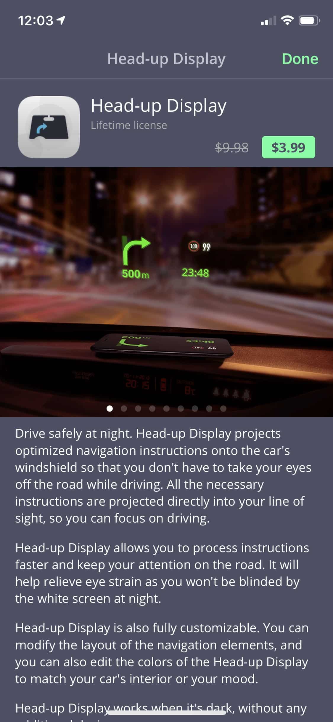
Sygic has some functions unique for GPS navigation apps. The first two rely on the phone’s camera; an over the car view and a dashcam function (this requires the phone to point out the windshield). Another Sygic feature is a head’s up display; the phone projects navigation directly in the line of sight for nighttime driving. These features are premium pay options within the app.
When avoiding data fees or venturing into areas with a weak signal, Sygic is a strong contender as the tool of choice.
Available for iOS and Android for free, with in-app purchases for premier features.
Best for Off-Road Travel: onX Offroad
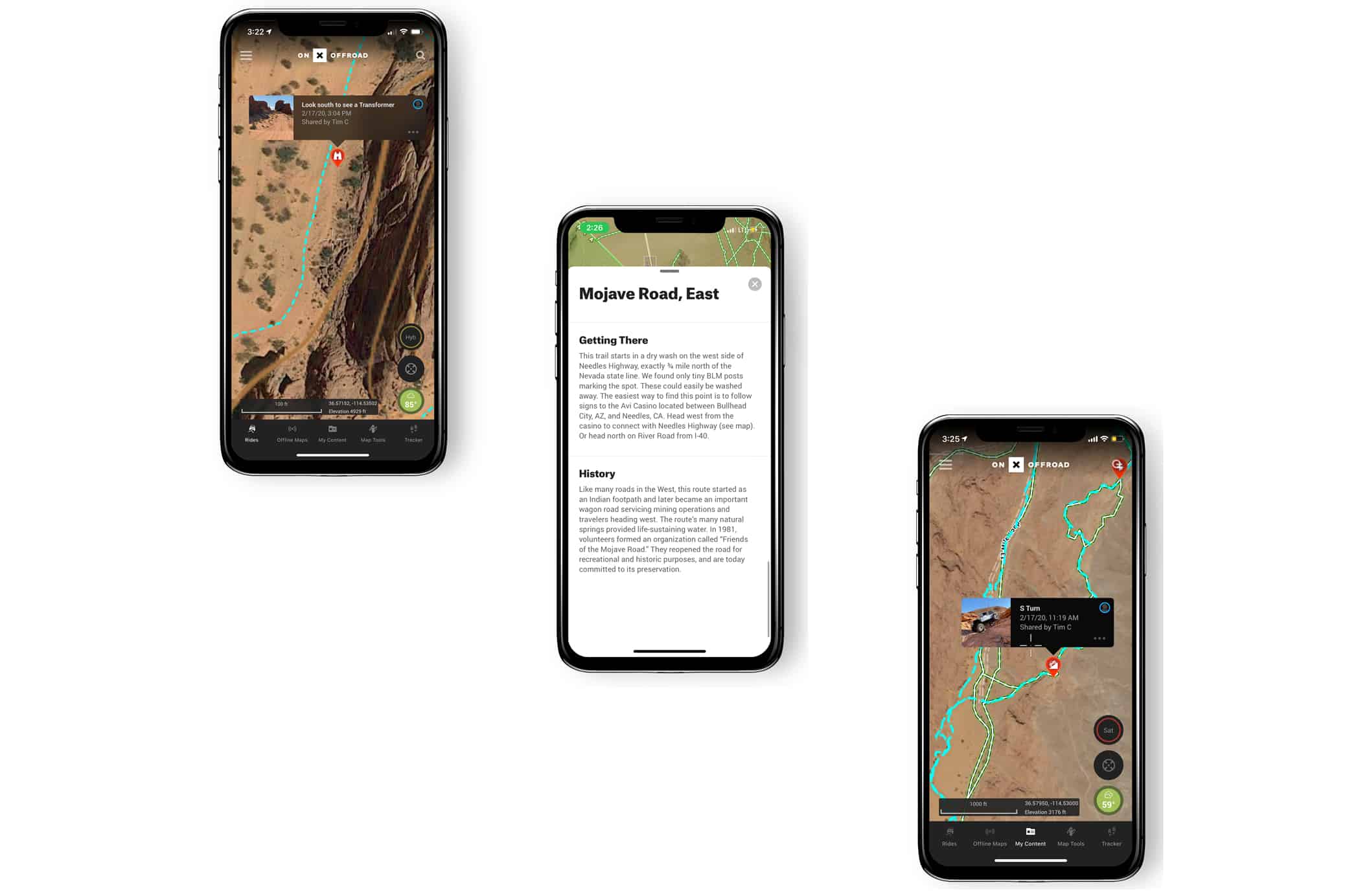
OnX is known for super robust app-based hunting maps, but recently launched an app specifically for off-road adventures. The new onX Offroad app highlights more than 400,000 miles of motorized trails in all 50 states and Mexico. These trails are accompanied by campgrounds, gas stations, vehicle restriction information, difficulty ratings, area history, and more. onX claims to add 4,000 miles of new trails weekly.
Maps are available offline in satellite, topo, or hybrid versions. Off-road trails are highlighted green for open and red for closed. Once on route, the app tracks all the stats: speed, distance, time, and the track. onX Offroad can store waypoints with images, and when the trip is over, all information can be saved and shared.
But the trip planning capabilities of onX Offroad are the real gem. A healthy bevy of trail information is on tap: vehicle required, trail composition, fee and permit information, open and closed dates, and further data to manage expectations.
onX bestows specific “featured” trails (highlighted in blue) with even more in-depth information; estimated travel times, distance, height elevation, images, technical ratings, details about hazards, area history, and more. Trusted guides and “elite users” create and evaluate this additional information.
The onX Offroad app’s robust maps, features, and information add security and enjoyment to venturing off the pavement in a format designed specifically for vehicle-based adventures.
OnX Off Road is available for iOS and Android for a free 7-day trial, then it is $30/year.
Best For Traveling Abroad: Maps.Me

Maps.Me utilizes the open-source OSM platform, which houses a vast and ever-growing amount of travel data from around the world. It updates at a rate of 3,500 contributions per day. This massive and current data source and offline capability are a few reasons why Maps.Me makes for a great overseas travel companion.
Maps.Me included navigation modes for driving, walking, and cycling around the globe, along with built-in travel guides with curated recommendations of points of interest and activities, which can include personal interests like outdoor activities. And speaking of these outdoor adventures, Maps.Me includes surprisingly robust maps of hiking trails.
The app also includes travel-specific offline search categories such as pharmacies and ATMs, which incorporates a smart search feature that deciphers typos and misspellings, common when traveling in foreign countries.
Other features include speed camera warnings, location sharing, integrated lodging booking through Booking.com, and Uber integration. And with internet access, Maps.Me can overlay public transportation maps and traffic information with your current location.
Maps.Me’s open-source data and tourist-friendly features make it a great companion for overseas adventures.
Maps.Me is available for iOS and Android, is free, and has in-app purchases for advanced features and ad removal.
What’s The Best GPS Navigation App For You?
Determining the best GPS app can be daunting due to the vast array of available options, both free and paid. Identifying critical characteristics, like offline functionality, that are make-or-break, can narrow the field. Comparisons can then be made surrounding how well each app performs these functions. Other primary considerations are ease of use and tolerance to advertisements, which can be plentiful in some free apps.
Some apps try to be the jack of all trades, and compromises are made. There is no need to settle for compromises these days, however. With all the options out there, it is easy to load a variety of GPS navigation apps on your smartphone. You can then utilize the best one for the particular navigation challenges you have at any given moment.
What is the best GPS app you’ve used?